14 Settembre 2015


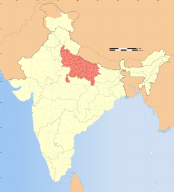
Un insediamento di 5000 anni fa nella valle dell’Indo, situato nel distretto di Baghpat dell’Uttar Pradesh, starebbe subendo gravi danni a causa dell’espansione umana e agricola nell’area, nonostante sia stato dichiarato protetto.
Link: The Hindu
L’Uttar Pradesh, da Wikipedia, CC BY-SA 3.0 Planemad/Wikimedia (Own work International Borders: University of Texas map library – India Political map 2001 Disputed Borders: University of Texas map library – China-India Borders – Eastern Sector 1988 & Western Sector 1988 – Kashmir Region 2004 – Kashmir Maps. State and District boundaries: Census of India – 2001 Census State Maps – Survey of India Maps. Other sources: US Army Map Service, Survey of India Map Explorer, Columbia University).

